 MoSS United Kingdom >
The wrecks of the project >
Netherland / Burgzand Noord 10 >
The BZN 10 wreck >
MoSS United Kingdom >
The wrecks of the project >
Netherland / Burgzand Noord 10 >
The BZN 10 wreck >
| MoSS United Kingdom |
| MoSS Deutschland MoSS Nederland MoSS Danmark MoSS Sverige MoSS Suomi |
| MoSS | What's on? | The main themes | The wrecks of the project | Links |
| Germany / Darsser Cog Netherland / Burgzand Noord 10 Sweden / E. Nordevall Finland / Vrouw Maria |
|
MoSS United Kingdom >
The wrecks of the project >
Netherland / Burgzand Noord 10 >
The BZN 10 wreck >
|
|
The BZN 10 Wreck - Threatened by Nature?
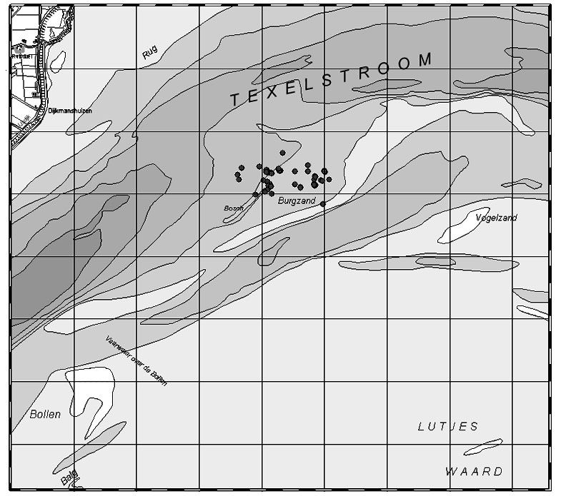
Picture 1. 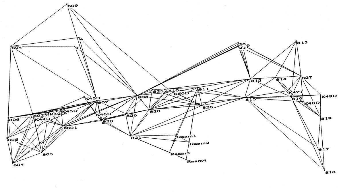
Picture 2: The "Web" of datum-points of the BZN 10 wreck. Drawing: ROB/NISA. 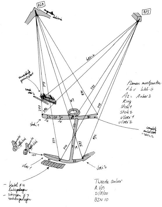
Picture 3: An underwater sketch of one of the anchors found on the BZN 10-werck. Notice the datumpoints 828 and 815 at the top of the picture. Drawing: ROB/NISA. 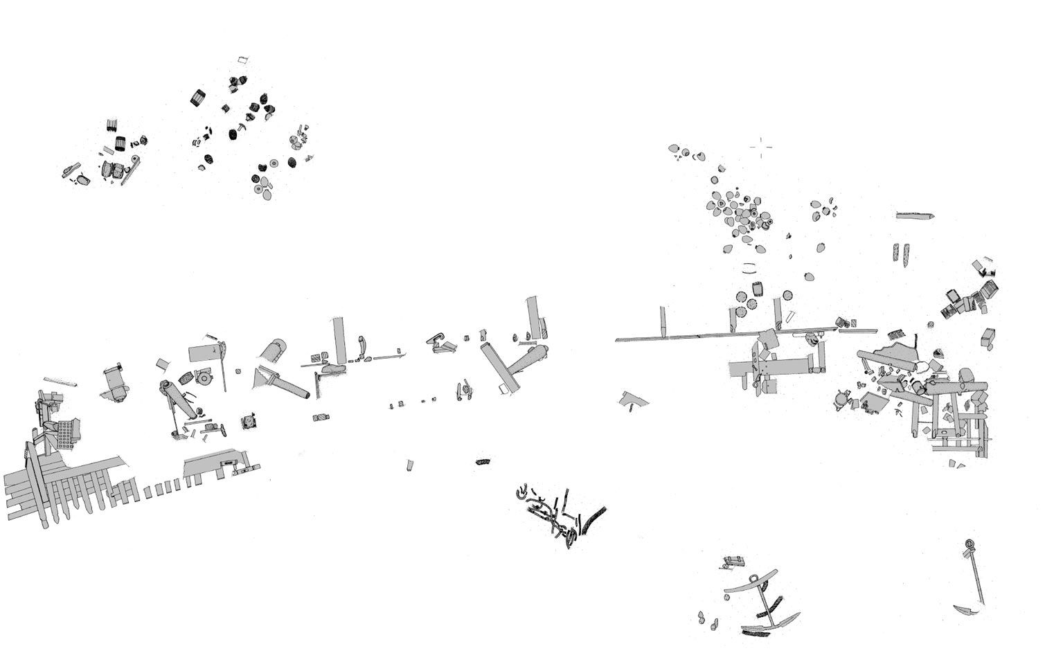
Picture 4: The result of combining the "Web-it" measurements with the underwater sketches. This picture shows everything of the BZN 10-wreck that surfaced the seabed in 2000. Drawing: ROB/NISA. |
The BZN 10 wreckOne of these twelve shipwrecks that have been valued in the Netherlands is the Burgzand Noord 10 (picture 1). The wreck was chosen to be one of the four shipwrecks involved in the EU project "Monitoring, Safeguarding and Visualizing North European Shipwreck Sites (MoSS)". The valuation of this shipwreck took twelve days. The site was not disturbed. To be able to make a picture of the wreck site, nails were hammered on specific points on the wreck. These nails were numbered and their distance and depth were measured. A computer program called "Web-it" plotted these points and their positions (picture 2), and then drawings made by an archaeologist under water were be placed exactly in the wreck (picture 3), resulting in a scaled map of the wreck site showing everything surfacing the seabed (picture 4). Only a few objects, mainly ceramics, that can help us date the wreck were taken from the site. Some wood samples for dendrochronological research were taken as well. |
Registration period for the Portsmouth Seminar over. |
|
|