 MoSS United Kingdom >
The wrecks of the project >
Netherland / Burgzand Noord 10 >
MoSS United Kingdom >
The wrecks of the project >
Netherland / Burgzand Noord 10 >
| MoSS United Kingdom |
| MoSS Deutschland MoSS Nederland MoSS Danmark MoSS Sverige MoSS Suomi |
| MoSS | What's on? | The main themes | The wrecks of the project | Links |
| Germany / Darsser Cog Netherland / Burgzand Noord 10 Sweden / E. Nordevall Finland / Vrouw Maria |
|
MoSS United Kingdom >
The wrecks of the project >
Netherland / Burgzand Noord 10 >
|
|
The BZN 10 Wreck - Threatened by Nature?
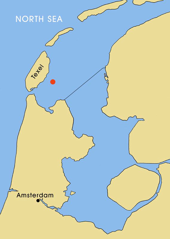
The position of the wreck BZN 10. Chart by Mikko Rautala. The Maritime Museum of Finland/The National Board of Antiquities. |
HistoryFor centuries, the Netherlands has been an important maritime nation. Amsterdam was a staple market for all kinds of goods within Europe. Grain from the Baltic region was traded here, as well as goods from the East and the West Indies. However, for a long time it was impossible for a big ship to enter the Amsterdam harbour with its cargo because of the shallow waters in this area (called Pampus). As a solution, big ships were loaded and unloaded on the Texel Roads, in the Wadden Sea in the North of Holland. Protected from the North Western winds by the Island of Texel, it was a relatively calm area. Relatively, because during centuries thousands of ships were wrecked by storms. One example is the storm on the 24th of December, Christmas Night, 1593. That night, a fleet of around 150 ships was caught by a South Western storm. In a few hours, 24 ships sunk and 1050 sailors died. Another example is the South Western storm on the third of November 1638. In that night 35 ships went down. Between 1576 and 1790, at least 32 severe storms are registered.1 One of the unfortunate ships that sunk during the Christmas Night of 1593 was the Scheurrak SO1. The wreck was excavated by the Netherlands Institute for Ship- and underwater Archaeology (ROB/NISA) between 1989 and 1997 when the NISA developed ways to do archaeological research in muddy waters.2 The wreck turned out to be that of a Dutch merchant ship with a cargo of (still well preserved) Baltic wheat. Scheurrak SO is not the only shipwreck located in the Western part of the Wadden Sea. In a small area of a few square miles, there are about sixty wrecks with possible archaeological value from the sixteenth, seventeenth and eighteenth century are located. Most of these wrecks have been found by local fishermen and divers.3 So far, the NISA has investigated twelve of these sixty wrecks in order to value them. 1. Information given by J. van Vliet, who's currently working on a data-base of storms on the Texel Roads. 2. ROB stands for the Rijksdienst voor het Oudheidkundig Bodemonderzoek (National Service for Archaeological Heritage). The NISA is part of this organisation (ROB/NISA). 3. The NISA doesn't have the policy of searching for shipwrecks. The main reason for this is the amount of reportings per year by fishermen and divers. Hundreds of shipwrecks are known in to be in the Dutch waters and on lands of the former "Zuiderzee". See also Habermehl (2000). |
Registration period for the Portsmouth Seminar over. |
|
|