Visualization by means of geophysical survey methods
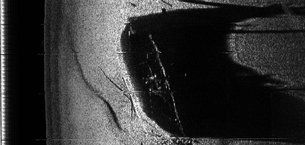
Numerous geophysical methods have been developed in the last decades to discover anomalies, "alien elements", in different soils and layers of the earth and even under water. An anomaly may for example be a shipwreck. These methods can be used in the investigations of wreck sites and their surroundings. The side scan sonar technology is one the most important technologies for this purpose. Hydro-acoustic signals of different frequency scan the bottom of the sea selectively. These signals are also transmitted into the soil and the reflected signals are recorded and evaluated. The radar technology is commonly used as well. Radar rays penetrate into the subsoil and information infers from the changes of the density in form of different structures. The changes of the density caused by for example a ship hull with its cargo obviously differ from the surrounding sediments. By these methods, it is not only possible to locate wrecks but with the help of modern graphical computer programmes it is also possible to make the wrecks visible to the public. Different geophysical methods will be used for the documentation and visualization of the Vrouw Maria, the Burgzand Noord 10 and the Darsser Kogge.
|
 MoSS United Kingdom >
The main themes >
Visualizing >
Visualization by means of geophysical survey methods >
MoSS United Kingdom >
The main themes >
Visualizing >
Visualization by means of geophysical survey methods >